Strong to Severe Storms on Thursday… Dry Weekend… Wednesday PM Forecast Update #alwx @wvua23
February 15, 2023 1 Comment
Good Wednesday afternoon! Our local weather started off gloomy this morning, with a few areas of showers. Skies remain mostly cloudy for most of our area, but most showers have ended.
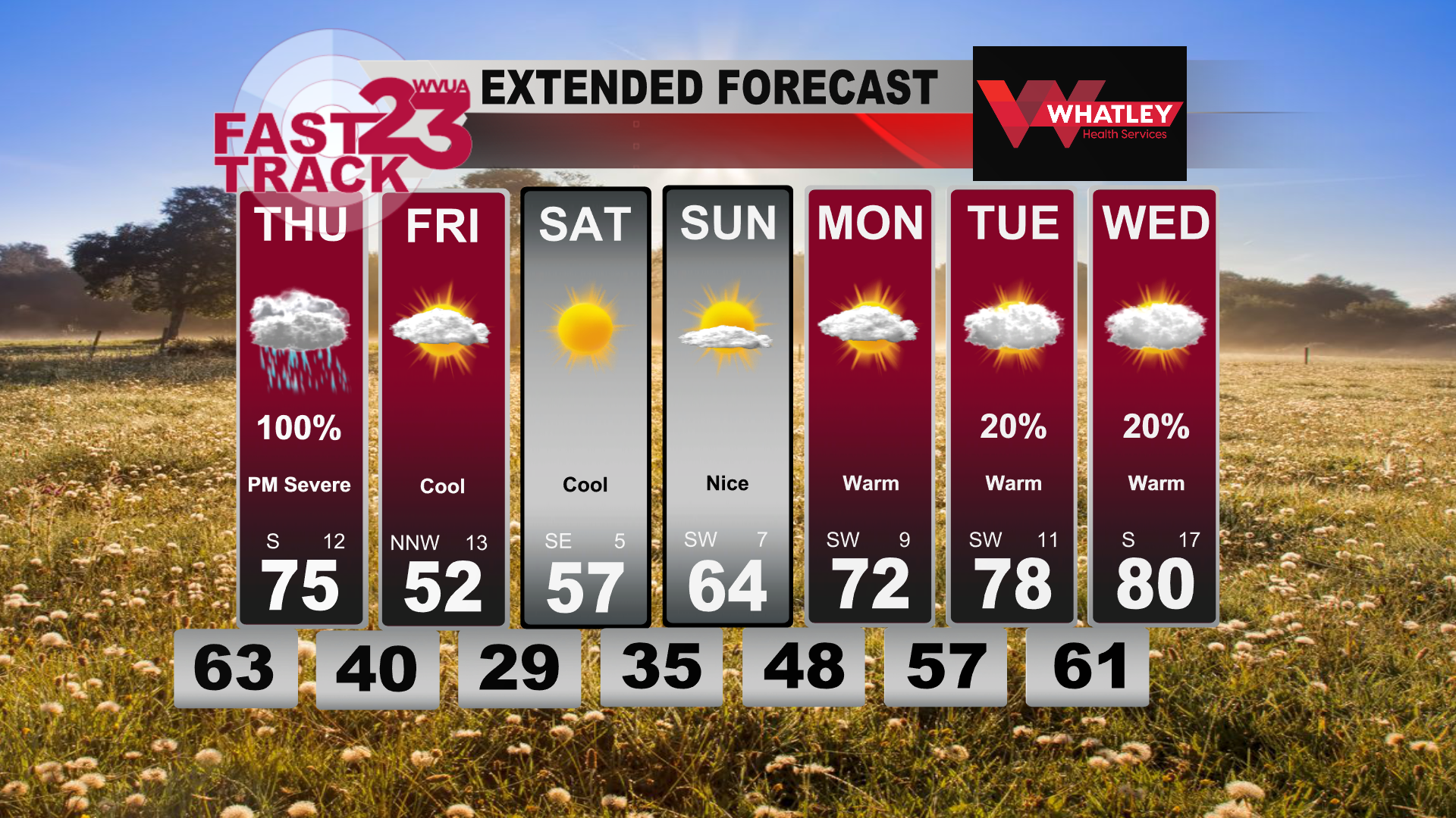
Temperatures will fall into the lower 60s tonight, then rise into the middle 70s on Thursday.
A storm system will pass through the area Thursday afternoon and early evening, with abundant instability and fair wind shear. The Storm Prediction Center has upgraded our area to an enhanced risk (level 3 of 5).
What time: The severe window begins around 12pm for west Alabama, ending by 7pm for areas west of I-65. East of I-65, your window is 4pm til 9pm.
What type: Storms could produce tornadoes, large hail and damaging winds. The higher tornado probability will be over west Alabama, but all of Alabama is in a risk.
As a reminder, we go on TV at WVUA23 non-stop during a tornado warning. We also stream non-stop on Facebook live too, search WVUA23. This is a good time to go over your severe weather safety plan and be ready to take action if needed.
Join us live on WVUA23 weekdays at 5, 6 and 10:00 P.M. and weekends at 10PM for the very latest on your news, weather and sports.
Twitter: RichardWVUA23
Facebook: RichardScottWVUA23
Weather blog:wvua23.com, click weather, select weather blog


Pingback: Sturdy to Extreme Storms on Thursday… Dry Weekend… Wednesday PM Forecast Replace #alwx @wvua23 - news page