Cold and Dry Tonight…Warmer Weather Coming In… #alwx @wvua23
February 17, 2023 1 Comment
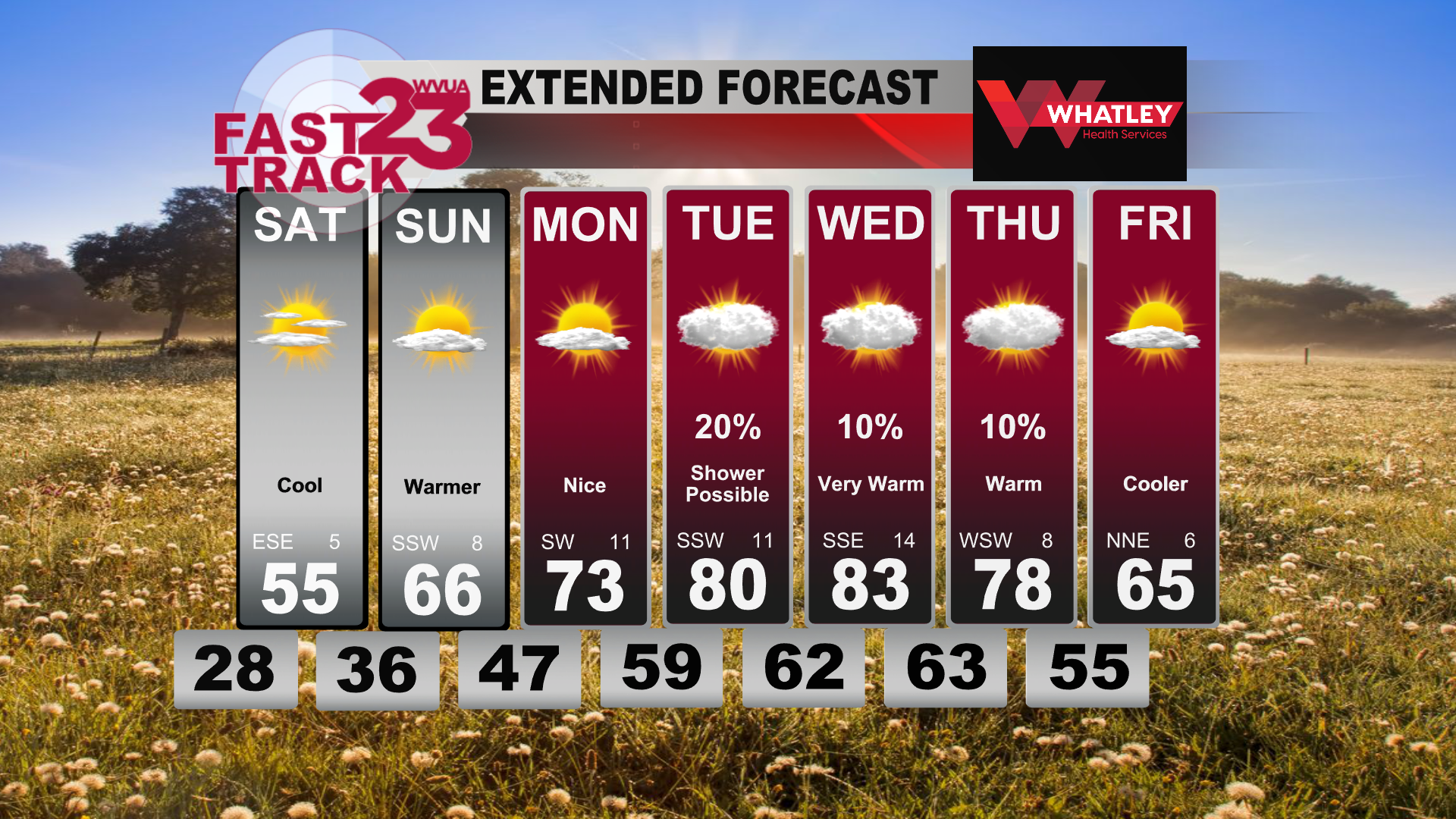
Happy Friday afternoon! After a rainy and stormy day yesterday, we are dry and chill this evening and tonight. Winds will continue to be on the breezy side this evening but will begin to decrease later tonight. Temperatures will drop into the mid and upper 20s for lows Saturday morning. The day on Saturday won’t be bad at all! It will be on the cooler side, with highs in the mid 50s, but the sunshine will make it feel a bit better. Sunday will feature warmer weather, with highs in the mid and upper 60s with a few more clouds.
Next week, it will feel like Mother Nature turned a couple of pages on the calendar! Instead of late February, we’ll be going straight to April and May! Highs will start off in the mid 70s Monday, but by Wednesday, we will be in the low to mid 80s thanks to a stout subtropical ridge in place! There will be clouds around, and a few showers possible, but for now, rain chances look to be on the lower end of things. On top of that, there doesn’t appear to be any strong to severe storm threat as of now which is nice to see!
Towards the end of the week, there should be a weak stalled out boundary nearby, so the forecast becomes a bit more uncertain, however, some slightly cooler weather could come back in briefly before next weekend.
Join us live on WVUA23 weekdays at 5, 6 and 10:00 P.M. and weekends at 10PM for the very latest on your news, weather and sports.
Taylor Plott
WVUA Meteorologist
tplott@wvua23.com
Twitter: tplottwx
Facebook: Meteorologist Taylor Plott


