Cold Night Tonight… Warming Trend Begins This Weekend… Sunshine Until Wednesday… Friday PM Forecast Update… #ALwx @wvua23
February 3, 2023 1 Comment
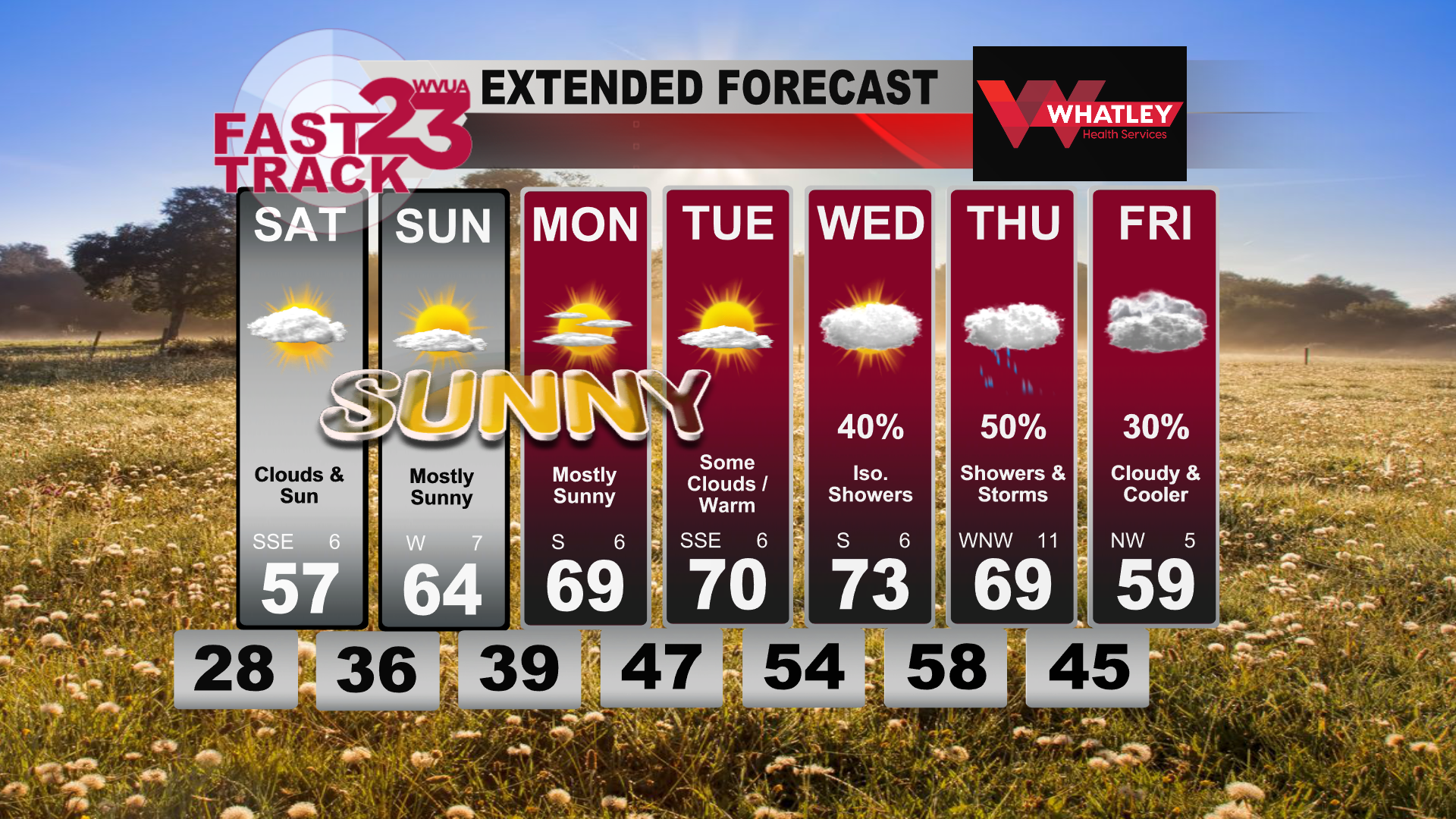
Good Friday afternoon! It was a beautiful day today with sunshine dominating the skies after the long week of dreary, cloudy weather. Temperatures today were on the chilly side once again with high temperatures barely reaching the low 50s by the afternoon. Temperatures will fall tonight, dipping below freezing for most places. Clearer skies continue through tonight and into tomorrow morning. Tomorrow, clouds will be on the increase again where we will see pockets of sun and clouds by the afternoon hours. High temperatures tomorrow will reach the upper 50s, beginning our weekend warming trend. A chilly morning on Sunday will give way to mostly sunny skies and temperatures in the mid 60s on Sunday afternoon.
Our warming trend continues into next week where we will flirt with high temperatures in the upper 60s and low 70s across Western Alabama. By Tuesday, high temperatures in the 70s will be more widespread with some clouds beginning to move in. Mild overnight temperatures will continue through the week sitting in the low to upper 50s.
Wednesday, our next system begins to work its way through, bringing the chance for some isolated showers during the afternoon on Wednesday. These showers increase on Thursday, where showers and storms seem increasingly likely during the day with temperatures still seasonably warm in the upper 60s and low 70s. Friday, the clouds stick around, but some cooler air settles in bringing our high temperatures back into the upper 50s.
Join us live on WVUA23 weekdays at 5, 6 and10:00 P.M. and weekend sat 10PMfor the very latest on your news, weather and sports.
Ryan Larmeu
WVUA Weekend Meteorologist
Twitter: ryanlarmeuwx
Instagram: ryanlarmeuwx
Facebook: Meteorologist Ryan Larmeu


